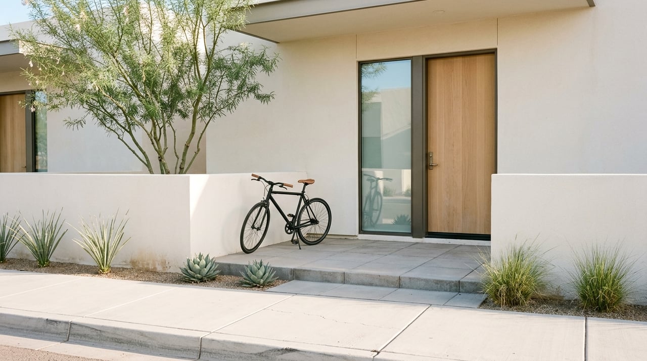
Car-Light Living In Tempe: Transit, Biking And Walkability
July 16, 2026
July 16, 2026
Tempe stands out in the Valley if you want to drive less without giving up convenience. If you are moving to the area, downsizing your commute, or simply hoping to make daily errands easier, Tempe offers a more practical car-light lifestyle than many people expect. The key is knowing where that lifestyle works best, what the transit options really look like, and how to match your home search to your routine. Let’s dive in.
Tempe has made car-light planning part of its long-term vision. The city’s transportation plan is built around a 20-minute city model, which focuses on reaching daily needs within a 1-mile walk, 4-mile bike ride, or 20-minute transit trip.
That matters if you want a home where errands, commuting, and recreation feel more connected. Tempe reports about 190,000 residents, 7.1 million transit boardings in FY25, sidewalks on 90% of streets, and 4% of residents biking to work. Those numbers support the idea that reducing your driving is realistic in the right parts of the city.
At the same time, it helps to stay grounded. Tempe still says vehicles are the primary mode of travel overall, so this is not a car-free citywide story. Instead, it is a location-specific opportunity.
If you want to rely less on a car, your best options are generally near downtown Tempe, the ASU area, the streetcar route, and the light rail corridor. These are the parts of the city where transportation, housing, and daily destinations line up most clearly.
Tempe’s planning documents concentrate growth in the Rail Corridor and other mixed-use areas. The city describes these areas as places for transit-oriented development, compact urban neighborhoods, and reinvestment near light rail.
Downtown Tempe is the clearest example. City planning materials describe Mill Avenue and nearby blocks as short-block, pedestrian-oriented, and built close to the sidewalk, with shade, street trees, and active ground-floor storefronts.
That physical layout makes a real difference. When blocks are shorter and destinations cluster together, walking becomes part of daily life rather than a separate event you have to plan around.
Valley Metro Rail is one of the strongest tools for car-light living in Tempe. The system spans 35 miles and 49 stations across Phoenix, Tempe, and Mesa, with service running more than 20 hours a day.
In Tempe, the city says there are nine light rail stops, and service runs 365 days a year. Valley Metro reports weekday trains every 12 minutes until 7 p.m., then every 20 minutes after that. First full trips begin between about 4:30 and 5:30 a.m., which can support early commutes or airport connections.
If your routine includes trips into other parts of the metro, this network can be a major advantage. It is especially useful if you want access to job centers, campus destinations, or entertainment without dealing with parking every time.
Tempe Streetcar adds another useful layer for local circulation. It runs 3.1 miles with 14 stops and daily service every 15 to 20 minutes.
The route functions as a downtown and ASU connector. City and Valley Metro materials note service to places like Tempe Beach Park, Marina Heights, Gammage Auditorium, and ASU sports facilities.
For many buyers, the streetcar matters less as a regional commute tool and more as a daily convenience feature. If you live near the line, it can make short trips to work, campus, events, or dining much easier.
Tempe’s bus system fills in many of the gaps between rail lines and local destinations. The city reports 13 bus routes, two express routes, one free FLASH route, and six free Orbit neighborhood circulators.
Orbit is especially worth noting if you are trying to cut back on short car trips. The city says these free circulators connect neighborhoods to shopping, schools, parks, and other local destinations.
Buses and light rail are also wheelchair accessible and include bike racks. That flexibility can make a big difference if you want to combine biking and transit in the same trip.
If transit is one side of Tempe’s car-light story, biking may be the stronger side. Tempe reports more than 220 miles of bikeways and was re-designated as a Gold-Level Bicycle Friendly Community in 2023.
That is not just a recreational label. The city’s bike map includes bike lanes, buffered bike lanes, separated bike lanes, and multi-use paths, which points to a transportation network that supports everyday movement.
For buyers who already bike, or want to start, this matters more than a broad city ranking. The real value is having multiple route types that can serve different comfort levels and trip purposes.
Tempe Town Lake is one of the city’s most useful walking and biking spines. The lake has 12-foot concrete paths on both sides, and the paths are open daily from 5 a.m. to midnight.
The north and south shores connect through the Mill Avenue bridges and the Rural Road Bridge. That gives the lake practical value for both recreation and day-to-day travel.
If you picture your ideal lifestyle including morning walks, bike commutes, or an easy way to move through central Tempe, this corridor deserves close attention.
Tempe also benefits from a wider network of canal and multi-use paths. City project pages highlight the continuous Rio Salado paths around the lake, the Western Canal path, Indian Bend Wash connections, and the Crosscut Canal through Papago Park.
These paths help extend bike and walking options beyond a single downtown core. They also connect Tempe to nearby parts of the region in a way that supports both practical trips and active living.
For some buyers, that network can change how they think about location. A home that is not directly on a rail stop may still feel highly connected if it has strong path access.
Tempe’s pedestrian network includes sidewalks, walkways, multi-use paths, and ADA-accessible amenities. The city says 90% of streets include sidewalks, which gives walking a stronger baseline than many suburban environments.
Still, sidewalk presence alone does not create the same experience everywhere. Walking is generally most practical in the downtown, ASU, and lake corridors, where destinations are closer together and street design supports more activity.
That is an important distinction if you are relocating from a denser city. In Tempe, car-light living is often about choosing the right pocket rather than assuming every neighborhood offers the same level of access.
If you want to live with one car instead of two, or simply avoid using your car for every errand, your home search should start with your routine. Think about where you work, how often you need transit, whether you like biking, and what destinations you want within easy reach.
In Tempe, the most functional car-light locations are often the ones closest to a cluster of transportation options. That can include light rail, streetcar access, bus service, canal paths, and a more walkable street layout all in the same general area.
This is especially relevant for relocation buyers, students, university employees, and professionals who value shorter, multimodal commutes. The Census Bureau reports a mean travel time to work of 20.9 minutes for Tempe workers in the 2020-2024 ACS, which supports the idea that shorter commutes are achievable in the right setting.
When you tour homes in Tempe, it helps to look beyond square footage and finishes. A property may feel completely different in daily life depending on how close it is to rail, streetcar stops, bike routes, and useful walking destinations.
Here are a few practical questions to ask during your search:
These questions can help you narrow in on the parts of Tempe that truly fit a car-light goal. They also help separate a home that sounds convenient on paper from one that works in real life.
The biggest takeaway is simple. Tempe can be a strong fit for car-light living, but it works best when you choose the right corridor and set realistic expectations.
Downtown Tempe, the ASU area, the streetcar route, and the light rail corridor offer the clearest path to reducing how often you drive. Biking infrastructure and multi-use paths strengthen that advantage, especially if you want flexibility beyond transit schedules.
If you are considering a move and want a home that supports how you actually live, transportation should be part of the conversation from day one. The right Tempe location can make your week smoother, your commute shorter, and your daily routine more connected.
If you want help narrowing down Tempe neighborhoods and properties that fit your commute, lifestyle, and long-term goals, connect with The Ackerman Team.
September 3, 2026
Blog
August 28, 2026
August 27, 2026
August 20, 2026
August 13, 2026
August 6, 2026
August 6, 2026
July 23, 2026
July 16, 2026
The Ackerman Team is dedicated to providing you with exceptional service and unparalleled expertise. Reach out to us today.